
Kesugi Ridge
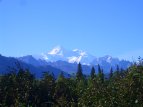


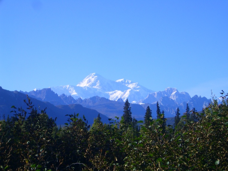
Denali is the highest mountain in North America, at 20,320 feet above sea level. From base to summit it's also one of the tallest mountains on earth.

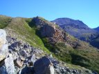
The initial climb from Little Coal Creek Trailhead.

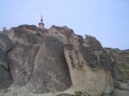
Just before decending into the valley, there is a very interesting set of glacier-carved rock formations. Here is Derrall on the rock we call "the pedestal".

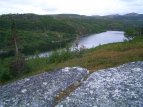
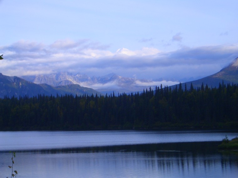
View of Skinney Lake after passing through the forested valley.
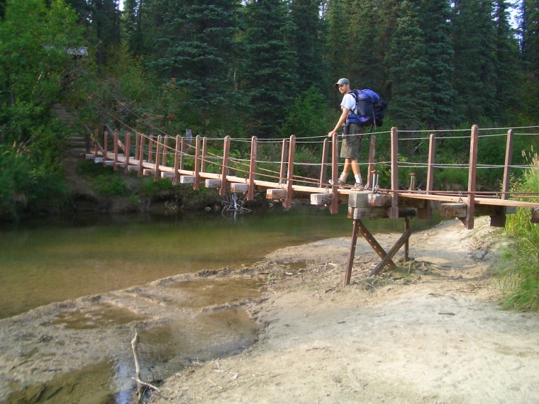
After making the final steep decent, you'll eventually reach this interesting suspension bridge. Here is my friend Derrall making his way across.
The trail ends just past Byers Lake. This view of Denali is common. On any given day, there is roughly a 33 percent chance of seeing the mountain.
Trail description:
With spectacular views of Denali and the Alaska Range, Kesugi Ridge is considered one of the best hikes in all Alaska. The trail starts from the Little Coal Creek Parking lot, and slowly heads uphill out of the surrounding forest. After clearing the tree line, several small man-made rock piles (known as cairnes) help mark the trail. After reaching the ridge top, the trail veers to the right and heads south. You can refill water from many small streams in the area. Eventually another trail is encountered on the right near a small pond. This leads back to the highway, so just continue strait. Shortly afterwards, an interesting section of the trail with bizarre rock formations is reached. From here, the trail heads back downhill, and into thick forest. There are several long 2 x 4 wood planks in this section to help you travel across wet patches of ground. Eventually, the trail rises out of the forest and onto flat stretches of granite. Look for 'Skinny Lake' on your left around this time. The trail passes the end of the lake, and then begins a tough uphill section. From here the tundra scenery will remain mostly the same for the next 8 miles. After passing the small lake called 'mini skinny', the trail begins the final and somewhat steep descent. At the bottom is a comparably larger lake, Byers Lake, and a path which leads to a lakeside campground on the left. Head strait to reach the end of the trail. Near the finish line is a very interesting suspension bridge crossing a small river.
Difficulty:
It's a long hike with many ups and downs. Be prepared for at least 3 days of hiking beforehand. Like much of Alaska, the weather can turn poor quickly. Make sure to pack accordingly.
Directions:
Take the Glen Highway north from Anchorage for roughly 50 miles, and follow the bend towards Wasilla. Continue north for 2+ hours, past Talkeetna, until Denali State Park is reached. Look for a sign for the veteran's memorial (where the trail ends). Continue past it for about 15 miles, and you'll find the Little Coal Creek parking lot on the right, where the trail begins.
Additional Information:
The view of Denali is the main attraction of this hike. It's visible along most of the trail, and is truly breathtaking. I recommend carrying bug repellent, as well as bear protection if possible. Bears are plentiful, especially in the lower forsested areas. I carry bear spray myself. Also, unlesss you want to hitchhike, be sure to work out a way to return to your vehicle at the original trailhead.