
Crow Pass
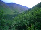
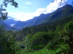

View from an early portion of the trail. The waterfalls and mine ruins are just a little ways ahead from here.
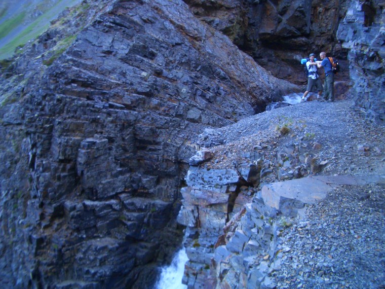
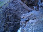
The rocky chasm and the first main waterfall. My friend Dave here is pretending to push my friend Derrall off a cliff, heh heh.

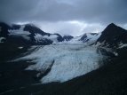
Spectacular Raven glacier. This photo was taken around 11:00 pm - yet still enough light out to take a picture in late July!
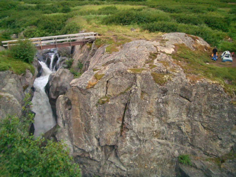
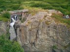
The bridge which crosses raven creek. We set our camp up next to the steep, rocky gorge.

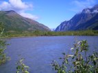
Here you can see where Raven valley meets up with the larger Eagle River valley, looking east. You can see Eagle Glacier on the left.

The Eagle River comes right from Eagle Glacier. Because of this, the water is freezing! Be careful, and don't say you weren't aware!
Trail description:
Crow pass is often considered one of the best hikes in the chugach mountains. It travels all the way from the outskirts of Girdwood, along Turnagain Arm, to a finishing point near the city of Eagle River. The first section of the hike is uphill with a relatively gentle incline. Ruins of an old mine can be seen early on, shortly before the trail makes it's way through a rocky gorge with several waterfalls. Be carefull; it can be steep here and there's plenty of loose rock. Afterwards, the trail begins it's main uphill section. It will split into left and right trails; either path can be taken because they meet up soon after. Once the high point is reached, a shallow pond known as Crystal Lake can be seen on the left, followed by a spectacular view of Raven Glacier up ahead. From this point the trail heads consistently downhill for several miles. A bridge is reached at one point which crosses another noteworthy waterfall. Raven valley eventually merges with the larger Eagle River valley, and here you will need to ford the Eagle River (read below). After the river-crossing, the trail heads left and begins it's longest stretch, following the valley to the west. From here on, the trail splits and re-joins several times. The best rule of thumb is to stay to the right, whenever possible. This keeps you higher up and out of the water more often. Regardless, there are some places which require you to cross shallow water on either route. Several wooden posts will let you know when you're almost finished. Eventually, the trail ends at the Eagle River Nature Center.
Difficulty:
Tough simply due to length. Thankfully, the only elevation gain happens in the first few miles. Crossing the river is, without question, the hardest part of the hike. The water is very, very cold, due to its nearby source being a glacier, and can be anywhere between 2 to 3 feet deep. Put simply, it can feel like freezing to death, while keeping your balance, while steadily crossing several dozen feet of river. It's a crazy experience, to be sure. Definitely something to consider beforehand.
Directions:
From Anchorage, head south on the New Seward Highway, past city limits, for about 45 minutes, until the city of Girdwood is reached. You should see a large gas station; turn left, and follow this road for about 2 miles. As soon as the road begins to curve right, look for Crow Creek Road on your left and turn. This should be a gravel road; after a while it will fork. Take the right fork (uphill) until a parking area is reached; the trail begins on the far side of this lot.
Additional Information:
Being a lengthy one-way hike, its a good idea to be dropped off at the trailhead, rather then leaving a vehicle there, to be picked up later. It's a long way back to Girdwood!